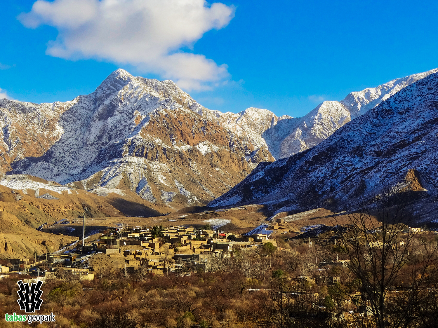
Shotori Mountain range in the east of Tabas Geopark, with a length of about 200 km, is one of the most significant mountainous areas in Iran, which is formed by the activities of the Nayband Large Fault and separates the two holes of Lut and Tabas. Geological conditions have caused this mountain range in this area of Iran to act as a huge barrier against air currents, leading to more rainfall in this area and creating a different climate from other parts of Tabas Geopark. Also, the calcareous nature of a large part of rocks along with the existence of faults has made Shotori mountain range the source of life and the main supplier of water in Tabas Geopark. The oldest rock units of this mountain range belong to the middle of the first geological period (Paleozoic) with an age of about 385-390 million years, and its highest peak in the east of Tabas city is 2912 meters above the sea level. The thickness of sediments in this mountain range is estimated to be about 7000 meters. The prominent features of this mountain range can be seen in few geological and geomorphological units of Iran, making it one of the main and most interesting geomorphological and hydrogeological phenomena in eastern Iran. Also, this mountain range is a paradise for geographers and geomorphologists from the perspective of natural geography, particularly geomorphology. Other attractions of this mountain range include plant and animal diversity, straits and deep valleys, historical monuments, villages with unique nature, springs, and so on.
– The scientific resources are available in the management of Tabas Geopark.
The use of this article is unrestricted by mentioning the source.