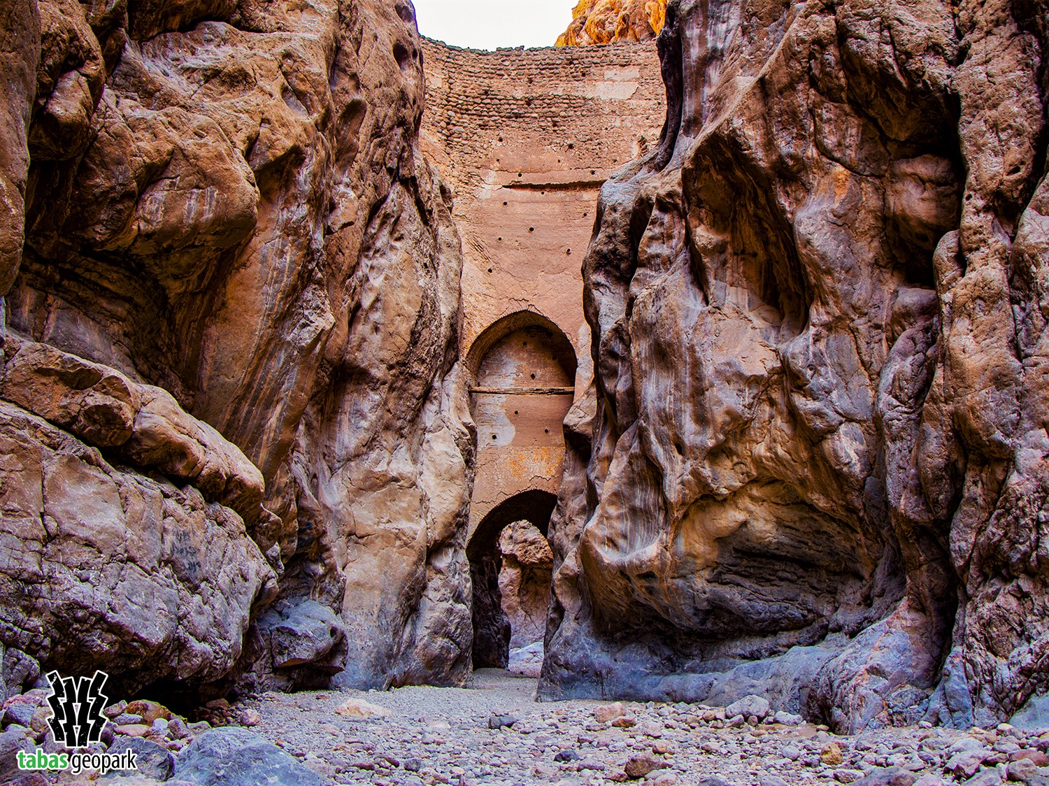
Geosite of Shah Abbasi Arch (Taq Shah Abbasi) is one of the most important cultural-historical and geoarchaeological attractions of Tabas Geopark, located in Kal-e-Sardar geosite. It shows a unique example of dam engineering and creativity of the ancient Iranians who made it in very difficult conditions due to difficult access to the location of this arch. The construction site of Shah Abbasi arch has been selected in the narrowest part of Kal-e-Sardar where the stones on both sides of the wall have the highest strength and the least fracture. The height of this arch is about 17 meters and probably because of the latest reconstructions done on it during the reign of Shah Abbas, it is known by this name. the width of the arch at the bottom is about 3.35 meters. The arrangement of the bricks in this arch is remarkable since they are not limited to a certain width, but rather extend radially to the mountain body and give considerable resistance to the arch. The type of materials used in this arch indicates that it has been restored and rebuilt during several different periods. Also, the riverbed was at a higher level in the past, but the river eroded its bed over time and became deeper as a result of tectonic activities and regional uplift, leading to an empty space under the arch.
Different opinions have been expressed about the construction of the Shah Abbasi arch and its use:
Mirza Ali Monshi Bashi, the poet of Tabas and the secretary of Emad al-Molk (ruler of Tabas), has written about this arch: Shah Abbas built an arch between two mountains to prevent floods and gradually direct the water to the city of Tabas. However, as the arch could be probably broken and flood the whole of Tabas, the construction was discontinued.
Daneshdoust (author of the book Tabas the Town That Was) believed that the Shah Abbasi arch was built to create a dam, and the openness of its lower part is the method used in the past to build dams. Also, the pottery pipes used in its body were a special method to deal with water. In this way, at the end of the summer and before the rainy season, the holes were closed and were then gradually opened after the water level rose.
– The scientific resources are available in the management of Tabas Geopark. The use of this article is unrestricted by mentioning the source.