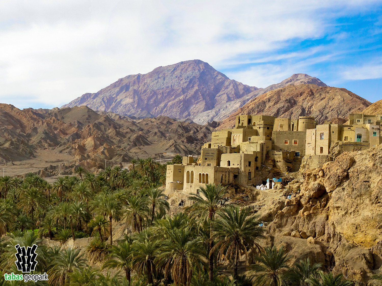
Nayband mountain with a height of 3005 meters is the highest point in Tabas Geopark and is known as the roof of South Khorasan province. Many mountaineers from all over Iran climb this peak every year. This geosite is located 210 km south of Tabas, along the Tabas-Kerman road, in the Naybandan Wildlife Shelter (Iran’s largest wildlife Shelter). It has created an average difference of 2000 meters in height with the surrounding plains. High mountain landscapes along with low plains of Lut desert, the beautiful village of Nayband, hot springs of Dig-e-Rostam and Zardgah, as well as plant and animal diversity of this geosite due to its location in Naybandan wildlife Shelter, have led to unique geotourism and ecotourism attractions. Nayband Mountain is an anticline structure whose oldest rocks date back to more than 700 million years ago (Precambrian).
– The scientific resources are available in the management of Tabas Geopark.
The use of this article is unrestricted by mentioning the source.