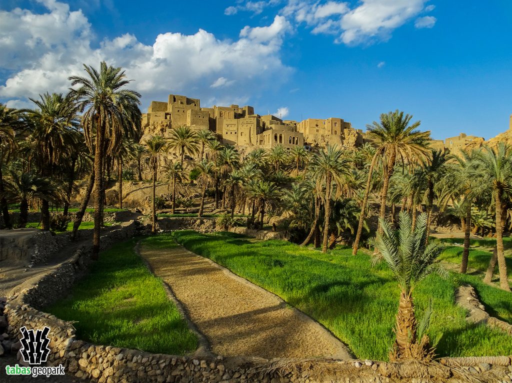
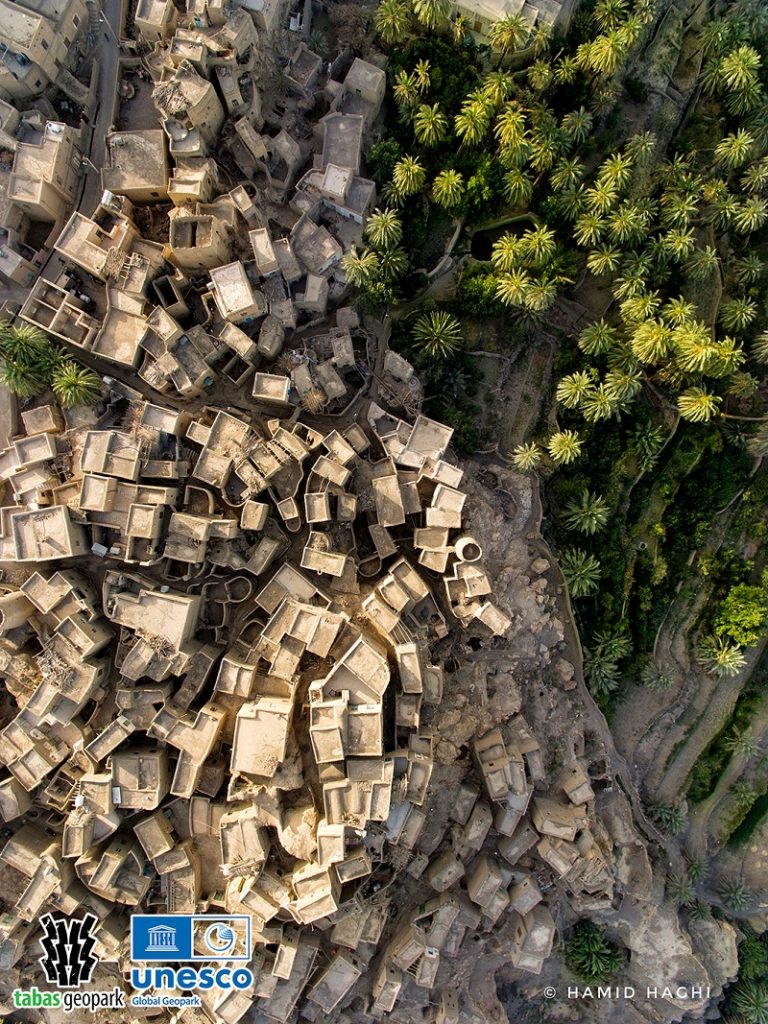
Nayband village is located 210 km south of Tabas on the Tabas-Kerman road. This village is one of the most unique examples of the historical texture of Tabas Geopark in Iran and the world. It had a strategic position in the past due to its location in the caravan route, and its history dates back to pre-Islamic times. Therefore, because Nayband is located on the border of desert and mountains and the route of caravans and miscreants, it has been interpreted as a bottleneck[1]. This was the local area that blocked this route; hence, it was called Nayband because “band” in Persian means blocking. The harsh climatic conditions on the edge of Lut desert, banditry in different historical periods, and lack of land has caused this village to be built in a compact and dense structure with various watchtowers (7 towers) and narrow alleys on the mountain, which can be completely justified from security perspective. Also, the oldest evidence of Nayband settlement can be seen in the form of Troglodytic architecture in the southern margin of the village. The village is surrounded on both sides by two wide valleys with date groves, citrus orchards, and agricultural lands and is visible as a green land in the desert of Lut from far away. Due to the natural and special location of this village, the houses are built in a stepped manner so that the roof of some houses is used as a high courtyard. This feature has made Nayband known as Masuleh[2] of the desert. The roofs of houses and sabats in Nayband are made mostly of wood. In historical documents, Nayband is mentioned as a resort on the edge of the desert. Sven Hedin (a famous Swedish desertologist) said about Nayband in his book Deserts of Iran: when Nader Shah set out to quell and suppress the Afghan insurgency, the village was a base for him and his troops. Elsewhere, he says that even a quick visit to Nayband is a motivation to travel all over Iran. A painter can spend several years there and at the same time find a new painting subject every day and return home with beautiful pictures.
Nearby Attractions
In addition to the stone- raw brick texture, there are other unique attractions around this village. The name of the largest wildlife shelter in Iran, Naybandan, which has unique ecotourism and geotourism attractions is taken from this village. Also, the name of Nayband Formation, which contains a large part of Iran’s coal reserves, is taken from this village. Cheetah, caracal, leopard, wild goat, chinkara, hyena, fox, sand cat, jackal, Persian hedgehog, porcupine, hare, reptiles (saw-scaled vipers, pseudocerastes, agama, and lizard), and birds along with vegetation which is unique to desert areas are the most important ecotourism attractions of Naybandan wildlife shelter. In addition, due to the vast expansion of the Naybandan Wildlife Shelter and the very low interference of urban, rural, and mining areas in the shelter, it has provided one of the darkest and suitable areas in Iran and the world for astronomical activities. In addition to ecotourism attractions, there are unique geotourism potentials such as rock outcrops from the first and second geological era, Zardgah and Dig-e-Rostam spas, Nayband mountain, Nayband fault, and deserts. Also, baskets, mats, wicker baskets, fan are the most important handicrafts of Nayband, and dates, curd, date juice, and oranges are among the most important products of this village.
– The scientific resources are available in the management of Tabas Geopark. The use of this article is unrestricted by mentioning the source.