Geographical Location
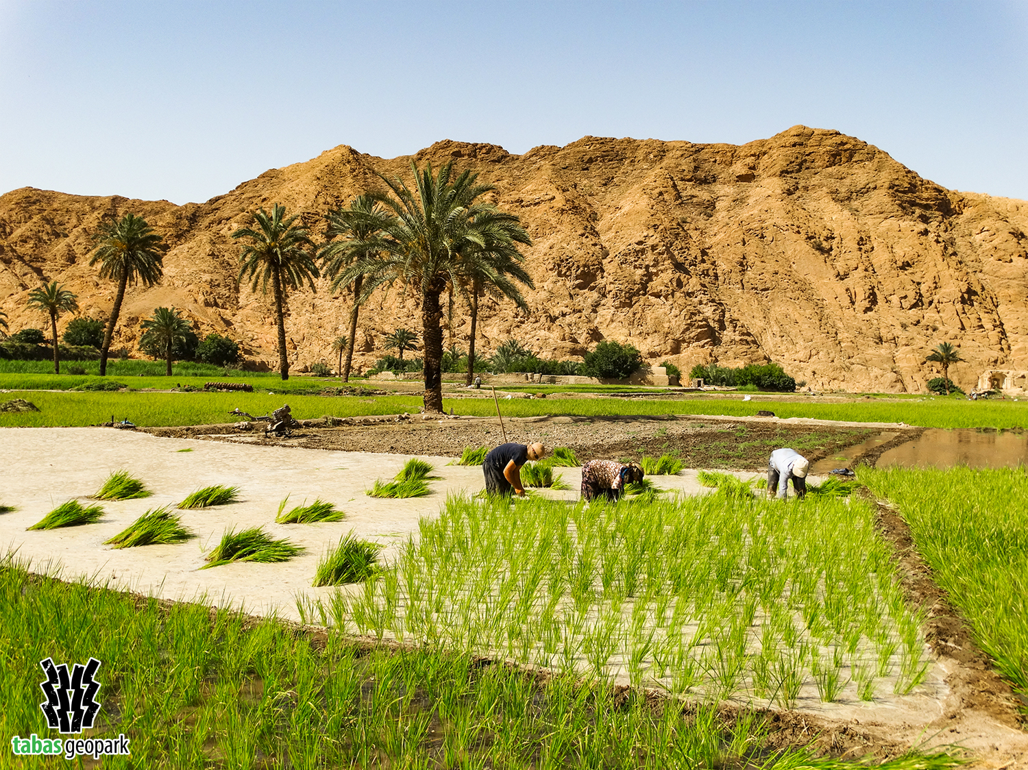
Geosite of Khanik paddy fields is one of the most beautiful and unique geosites of Tabas geopark and the world, providing the possibility of cultivating rice next to desert areas. These paddy fields are the most extensive agricultural sector of Ezmighan village and have created spectacular as well as unapparelled landscapes along with date palms, citrus trees, and Shotori mountain heights. Also, a part of the original texture of Ezmighan village, with evidence of the life and settlements of early humans in alluvial walls, has been built in the vicinity of these farms.
Geological Importance
This geosite is located in a part of Shotori Mountain Range where geological conditions played a special role in the exploitation of these farms, leading the natives to choose this place for the development of agricultural activities. The presence of marl bed (a type of carbonate rich mud or mudstone with the least amount of permeability) and the location of one of the largest meanders of Shotori mountain range are among the main factors in the development of paddy field in this geosite. Most importantly, the constant presence of water whose origin is mainly related to faults and fractures is an indescribable blessing in this desert region.
– The scientific resources are available in the management of Tabas Geopark.
The use of this article is unrestricted by mentioning the source.