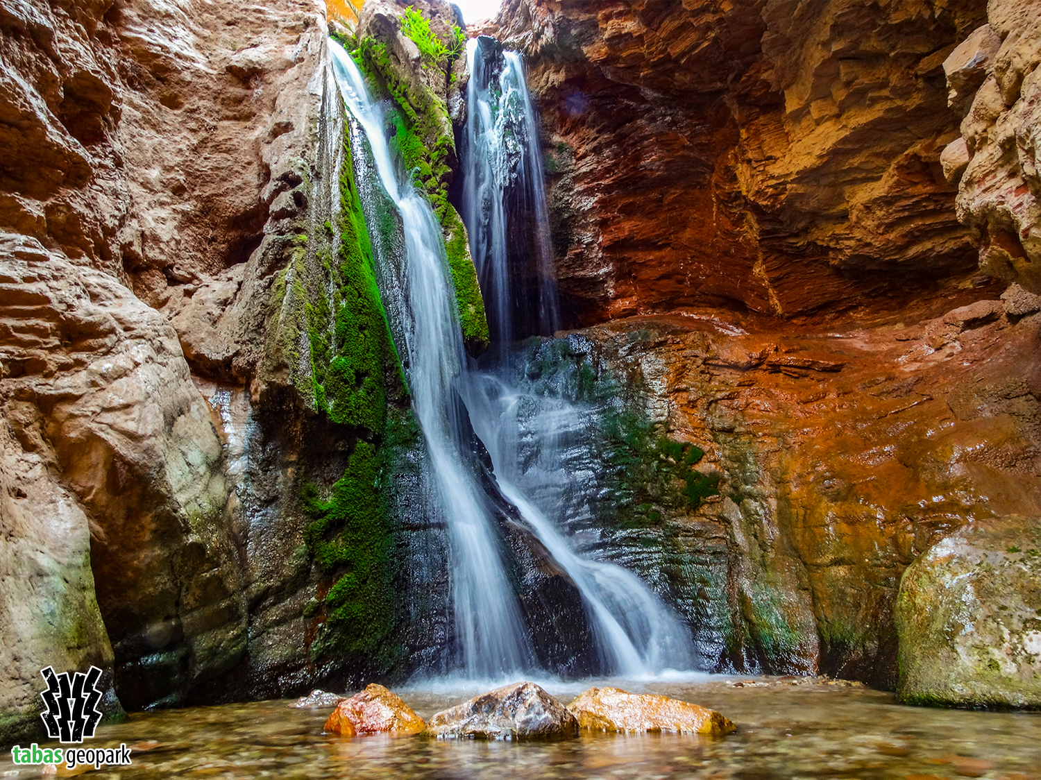
Geosite of Kal-e-Tafto, located 50 km southeast of Tabas and north of the Esfahk village, is one of the most beautiful geosites of Tabas Geopark in terms of diversity of natural and geological attractions. The high walls of this valley reach more than 300 meters, and the width of the valley reaches about 50 meters in some places. Limestone and sandstone rocks of the Sorkh Shale Formation with a red color (245-250 million years ago) and limestone-dolomite rocks of the Shotori Formation (228-245 million years ago) with yellow to buff color form the walls of this geosite. Also, the growth of a large number of plants and trees along with the constant flow of water in its riverbed have created a unique landscape and scenery in this desert region. One of the main streams of water in the Shotori Mountain Range flows in the bed of this valley and is the main source of life and agricultural development of the village of Korit as one of the most important agricultural hubs in Tabas Geopark. The most significant and characteristic attractions of this geosite are plant and animal diversity, stepped waterfalls, meanders, water basins, various folds and faults in different scales, and erosion forms. The upper part of the valley is also known among the locals as the Strait of Korit (Tang-e-Korit), at the end of which the Old Korit Dam is established as the oldest, tallest, and thinnest arched dam in the world.
– The scientific resources are available in the management of Tabas Geopark.
The use of this article is unrestricted by mentioning the source.