Geographical and Geologic Location
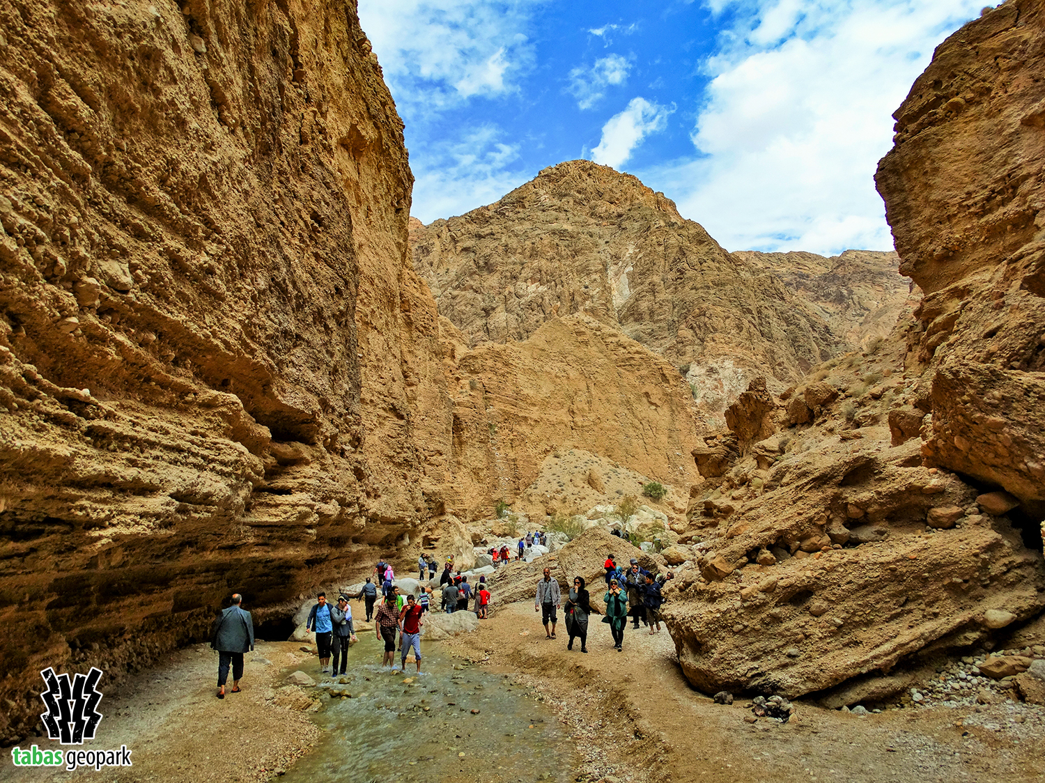
Kal-e-Sardar Geosite (Sardar Valley) is one of the unique and most beautiful attractions in Iran, located east of Tabas Geopark. This valley starts from the middle parts of the Shotori Mountain Range and ends with a length of 27 km in Tabas plain. A large part of this geosite is located in the tourist area of Kharv, and rocks of the late first (215-380 million years ago) and the second (145-175 million years ago) geological periods are evident in different parts of the valley. Also, the youngest rocks and sediments of this valley belong to the late third geological period (Quaternary period: around 2.5 million years), mainly spread in the Tabas plain.
Geosite Attractions
There is a wide range of cultural-historical and geological attractions in different parts of this geosite. The ancient houses of Gabr (Zoroastrians) and Shah Abbasi arch represent a part of the past civilization of this region of Iran. Petroglyphs, Ghulāt fort, hot and cold springs, folds, meandering rivers, angular unconformity, and natural landscapes of the valley surrounded by mountainous and calcareous heights are other important attractions. The water flow of Sardar valley is provided by several springs, located along its route and as the main source of life in Tabas city. The height of Sardar valley walls varies from 45 meters in alluvial sediments to more than 300 meters in mountainous areas.
– The scientific resources are available in the management of Tabas Geopark.
The use of this article is unrestricted by mentioning the source.