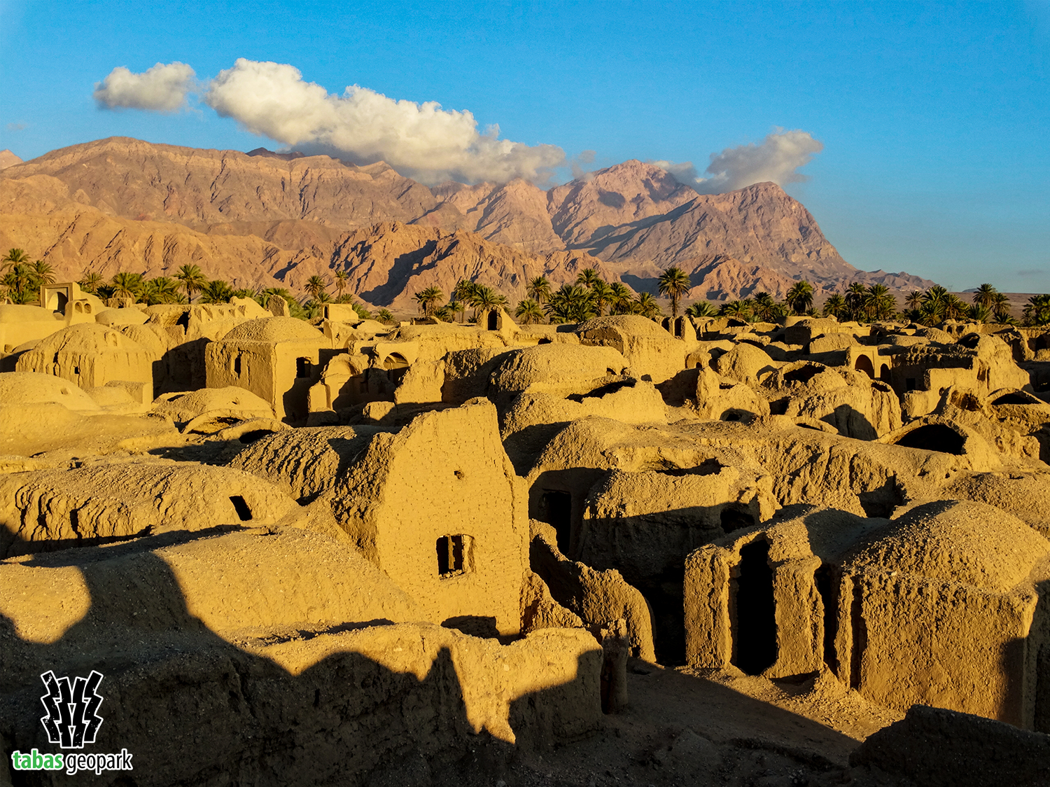
The view of brick domes in the background of date groves and lush fields indicates an ancient and beautiful settlement called Esfahk at a distance of 37 km southeast of Tabas and on the side of the Tabas-Deyhuk road. This village is located like a green gem on the western edge of the Shotori Mountain Range and overlooks the Tabas Plain. Historical village of Esfahk was join to World’s Best Tourism Village Network by World Tourism Organisation (UNWTO), in 15 Nov 2024.
Part of the historical fabric of this village was destroyed as a result of the Tabas earthquake in 1978, after which the villagers left the raw brick houses and established a new texture next to their old village. In recent years, the historical texture of the village, which was destroyed by the earthquake and abandoned, has been rebuilt by the villagers and turned into ecotourism residences. The reconstruction and revival of the historical fabric of the village by local communities has become a very valuable model for other regions of Iran and the world, and it shows well the various goals of sustainable development. The historical texture of Esfahk is one of the unique and original examples of native Iranian architecture. The original architectural patterns in combination with mosques, hussainiyas, baths, and water reservoirs (Ab Anbar) on the one hand and the historical effort of residents to survive in harsh climatic conditions indicates a wide range of cultural, social, and historical values of this region of Iran. Also, the extensive water resources and fertile soil have made Esfahk one of the most prominent agricultural hubs of Tabas Geopark, with products such as cucurbits, dates, oranges, and saffron.
In addition to the very valuable historical texture, other attractions in and around Esfahk that attract the attention of every viewer include Zerg shrine, ancient Korit dam, mountainous landscapes, the first and second geological era rock outcrops (Devonian to Jurassic and from 175 to 390 million years ago), various mineral resources (foundry sand and bentonite), and beautiful Kal-e-Tafto and waterfalls.